


Find Restaurant
Tateyama Kurobe Alpine Route
Very popular mountain sightseeing route surrounded by the great nature.
A good starting point for mountaineering and trekking.
-

shirohacha koshitsu annex
Toyama Station, Toyama
Sushi, Japanese
44.28 km
-

Charcoal & Dining Sharaku Himi-ten
Himi, Toyama
Izakaya (Japanese tavern), Taverns
70.23 km
-
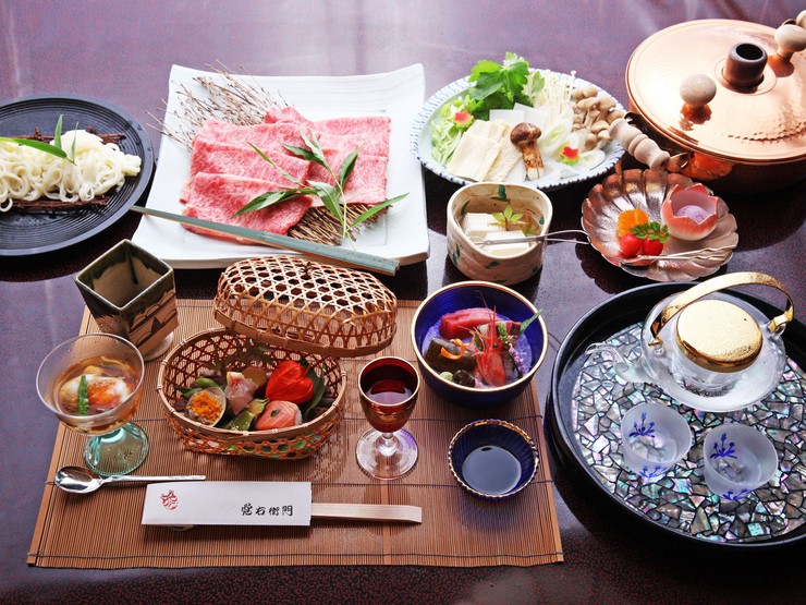
Ryoutei Kakuemon
Tonami/Gokayama, Toyama
Kaiseki (course menu), Japanese
71.56 km
-
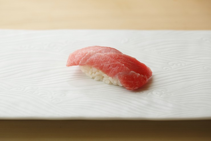
Sushi Daimon
Uozu/Kurobe, Toyama
Sushi, Japanese
34.71 km
Area Map

Tateyama Kurobe Alpine Route is a path that connects Tateyama station and Ogizawa station. The direct distance is just 25 km (approx. 15.5 miles), but the maximum elevation change of 1,975m (approx. 1.2 miles) makes it an internationally known large-scale mountain sightseeing route. A variety of vehicles are used along the route including cars, ropeways, cable cars, and trolley buses that run in a tunnel. Most of the route is traversing a national park, running through many scenic spots including the Kurobe Dam. There are many lodging facilities along the route, and each one is always full of people, providing the cardinal point for walking, mountaineering, and trekking.
There are many highlights, but the most famous one is the "Snowy Otani." The beautiful "snow wall" of accumulated snow along the route as high as 10m (approx. 33 ft.) is just overwhelming.
Address
Nakaniikawa-gun, Tateyama-machi, Toyama
Access from major landmarks
Toyama regional railway station from Tateyama station 60 minutes by train
or
Alpico traffic Nagano Shinano Omachi station from ogisawa station 40 minutes by bus
・・・
・・・
